When the Harbour Became the Town Centre
How a harbour becomes a town centre: follow an invented coastal settlement to see how landing places, work and exchange shape streets and buildings.
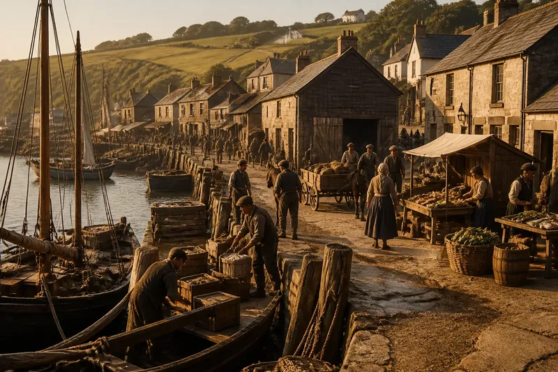
A harbour becomes a town centre when the routes serving boats begin to organise life on land. In a small coastal settlement, the first market, storehouses and meeting places often gather near the safest landing, then draw streets inland as trade and everyday services expand. The harbour does not need to be grand; it needs to be useful often enough for people to build their routines around it.
That change is easiest to understand by following one invented place from a landing beach to a settled town. The point is not that every harbour follows the same script. Shore shape, weather, cargo, local decisions and access to inland routes all leave their mark. But the order in which needs accumulate can explain why a town’s centre sits where it does, even after the original work has moved elsewhere.
Where does a town begin beside the water?
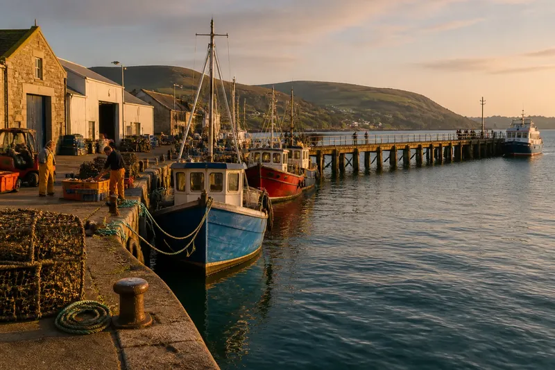
Imagine a sheltered inlet called Greyhaven, with a low ridge behind it and a track leading inland to farms. The first residents use a firm stretch of shore where small boats can be brought close to dry ground. A stream supplies fresh water nearby. The landing is convenient, but it is not yet a town centre: there are no permanent trading rooms, and most households remain close to their fields.
The inlet’s shape gives the landing a practical advantage. A headland reduces exposure to some winds, while the sloping shore offers a place to unload by hand. The settlement does not begin by choosing a civic centre. People choose a place to land, and then return to it because the same combination of shelter, water and access keeps being useful.
A few buildings appear where repeated tasks can be done without carrying goods far. A shed holds nets and tools; a simple store keeps provisions dry; a dwelling faces the landing so someone can watch boats arrive. Their positions are responses to work, not a formal plan. They also establish a small cluster that later visitors can recognise as the natural place to meet.
How do arrivals turn into regular exchange?
Greyhaven’s boats begin carrying fish, salt and repair materials between nearby settlements. Farmers bring grain and vegetables down the inland track, then take sea goods home. At first, exchange happens when a boat arrives or a household has something to spare. As visits become more predictable, people have reason to wait at the landing, keep goods in one place and agree where a sale will take place.
A sheltered patch of ground beside the store becomes the customary meeting point. It may be no more than a cleared space, but its position matters: goods come off the boats there, and the inland track ends close by. A market does not need a handsome building to affect the map. Once buyers and sellers expect to find one another in the same place, nearby paths acquire a destination.
Picture an invented change in Greyhaven: a farming household brings a cartload of grain to the landing on the same day that a boat is due with salt. The household waits beside the store rather than carrying the grain from door to door; the boat’s crew unloads near the cart; both parties can see and handle what is offered. The observable result is a reliable meeting place, followed by a worn path between it and the inland track. The exchange is modest, but the shared location is the beginning of centrality.
Regular exchange also creates new kinds of work. Someone has to sort, carry, mend, weigh or store goods. Boat crews need food and lodging; traders need somewhere to keep records; residents need tools and provisions. Each new task gives a reason for another building to appear near the landing, because distance adds effort when cargo is heavy or time is limited.
Why do the first streets follow the work?
At Greyhaven, the earliest route inland is the farm track. It reaches the market ground by the easiest gradient, so houses and workshops gather along it. A second path follows the shore between the landing and a sheltered cove where boats can be repaired. The two routes meet near the store. That junction becomes more useful than either endpoint alone, and a lane begins to form around it.
The built pattern grows in practical increments. A cooper’s workshop sits near the place where barrels are filled and moved. A food seller takes a position where crews and local traders pass. A lodging house occupies a dry plot near the inland route, where visitors can arrive without crossing the working area of the landing. These uses create a centre through repeated movement rather than a decision to draw a square on a map.
Buildings also respond to the shape of the ground. The shoreline may be awkward for carts, while the ridge offers firmer foundations but a longer walk to the boats. Greyhaven’s first streets therefore follow a compromise: close enough to carry goods to the landing, high enough to avoid the wettest ground. Narrow lanes can turn around steep or uneven plots; wider routes appear where carts need room to pass or turn.
It is useful to read a town plan as a record of such compromises. A street that runs directly from the harbour to a church or market may mark a route used by many people. A lane that bends around a low patch may reflect ground conditions rather than a lack of civic ambition. The pattern is less like a diagram and more like a household’s drawer: what is used often stays near the front, and awkward corners acquire their own logic.
What happens as the landing becomes a harbour?
Greyhaven’s simple landing eventually proves inconvenient for larger and more frequent arrivals. Residents extend a timber platform into deeper water, add mooring posts and improve the store. Later, a stronger edge of stone provides more dependable working space. Each change makes unloading easier, but it also concentrates movement at particular points. Streets leading to those points become busier, while routes that once served the open shore lose importance.
The harbour’s new facilities influence where buildings go. Stores cluster near the working edge, but homes may sit farther inland, away from noise, damp and the busiest handling. An inn or tavern occupies a junction between harbour traffic and the settled streets. A public building may appear close enough for workers and visitors to reach, yet not so close that it obstructs loading. The result is not a single line of buildings along the water but a set of linked zones.
Those zones are distinct without being sealed off. The harbour edge handles boats and cargo; the adjoining streets accommodate merchants, workshops and food sellers; quieter residential lanes climb towards the ridge. A visitor might move through all three within a short walk, but each has a different daily rhythm. The town centre is therefore a network of destinations, not necessarily one open plaza.
Where land is scarce, the harbour can pull the town into a compact form. Where a broad flat area lies inland, the streets may spread between the landing and a separate civic space. A church, assembly room or market hall can take over some central functions without erasing the harbour’s influence. People may still describe the waterside as the old centre because trade, travel and local memory remain tied to it.
What can the street plan tell you about the harbour’s influence?
For Greyhaven, the most revealing clues are not a single landmark but relationships: which streets point towards the water, where they meet, and what kinds of buildings occupy the routes between shore and inland ground. A present-day walk can test a simple question: does the street network make it easier to move between the harbour, the market area and the oldest settlement routes?
- Look for direct routes to the water. A street ending at a landing or working edge may preserve an older approach, even if its original use has changed.
- Notice junctions near former storage sites. A broad corner or small open space beside old warehouses may have served as a place to sort or exchange goods.
- Compare building types by distance from the shore. Former stores, workshops and lodging houses can suggest how work and residence were arranged.
- Watch for changes in street width or direction. These may reflect cart movement, slope, property boundaries or a shift in the harbour’s working edge.
- Check where public buildings sit in relation to old routes. A town hall or market building may have joined an established centre or helped draw activity inland.
These are clues, not proof of a single story. A straight route might be recent; a large building might have served a purpose unrelated to the harbour. Plans, local records and signs on buildings can help distinguish a surviving pattern from a later imitation. If access to a working harbour is restricted, observe from public routes rather than entering operational areas.
What if the harbour’s work moves away?
Greyhaven changes again when boats need deeper water and larger working areas than the old inlet can provide. New facilities develop beyond the original settlement, connected by a road that bypasses the market streets. Cargo now leaves from the newer site. The old harbour loses some work, but it does not lose every reason to matter.
Buildings around the earlier landing are adapted rather than simply abandoned. A store may become a workshop or a place to sell provisions; a lodging house may serve visitors who arrive by road; an old working lane may become a route to homes and public spaces. Some buildings remain empty for a time because their size or position suits an earlier trade better than a new one. That pause is part of the town’s history, not a failure to complete a tidy redevelopment.
The centre may shift in stages. Shops and services follow the road junction, while public buildings move towards a more accessible inland site. Residents still use the harbour edge for local travel, recreation or small-scale work. Greyhaven now has more than one centre of activity: the old waterside retains its place in the town’s layout, while daily errands gather elsewhere.
This change is why a harbour town can feel organised around a waterfront even when little cargo is handled there. Routes, plot boundaries and building positions can outlast the work that first made them useful. The historical centre may survive in a street name, a bend in the road or a row of narrow plots more clearly than in the current use of any one building.
Which questions help explain a harbour town’s layout?
Why are older shops often close to the harbour?
They may have served crews, traders and residents moving goods between boats and inland routes. Their position reduced carrying distance and made the passing trade easier to reach.
Why does the main street sometimes run inland rather than along the shore?
The inland route may connect the landing to farms, roads or a safer building area. A harbour town often needs a link between water and hinterland more than a continuous street beside the water.
Can a town have two centres at once?
Yes. The harbour can remain a centre for work, visits or public life while shops and services gather around a newer road junction or civic space.
How can a visitor tell whether the harbour shaped the town?
Look for routes that connect the water to older streets, and for building clusters positioned along those routes. Local maps and building records can help clarify how those relationships changed.
What does Greyhaven’s growth leave behind?
Greyhaven’s centre formed through a sequence: a useful landing, repeated exchange, buildings close to work, and streets linking the shore to inland routes. Its later harbour improvements strengthened that pattern before changing transport needs pulled some activity elsewhere. No single building created the town centre. Repeated choices about where to land, carry, store and meet did the work.
For anyone looking at a coastal town, the useful question is not simply where the harbour lies. Ask which routes made arrival convenient, where goods could be handled, and what kind of ground supported expansion. The phrase “harbour town centre” becomes more precise when those connections are visible. Even where the waterfront has changed, a street that still leads towards the old landing can show how the town once fitted its daily life around the water.